Miwah Gold Project
-
Project Highlights
- 3,140,000 oz Au, open on along strike, across width and at depth, in Protected Forest Reserve
- High-level, high sulphidation epithermal gold prospect
- Gold and copper mineralization
- Samples including 20.14 g/t gold and 83.59 g/t gold
- Access via major national highways
Miwah is located at the northern tip of Sumatra Island in Aceh Province within the Sumatran fault system and consists of three contiguous Exploration Mining Business Permits or Ijin Usaha Pertambangan (“IUP”): IUP 634, IUP 635 and IUP 636. The Miwah Gold Deposit lies within IUP 634, which is located approximately 130 km southeast of Banda Aceh. The total area of the Miwah IUP group is 30,000hectares. The property is accessed via major national highways to the nearest city, Takengon, and then 50 km via a sealed national road to Geumpang, and the project is 9 km outside of Geumpang.
Miwah’s Significant Potential to Increase Resource
- The Mineral Resource Summary shown above provides detailed results of the current Miwah Resource Estimates (click image to enlarge).
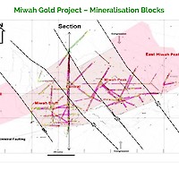
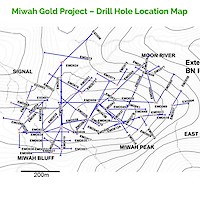
- Miwah Mineral Resource Model (NI 43-101, I.Taylor,2011) derived from 76 drill holes drilled at Miwah Bluff & Miwah Peak only. Drilling defined a Resource 1300m along strike, 400m in width and 300m deep.
- Resource Model (NI 43-101, I.Taylor,2011) defined an Inferred Resource of 103.9Mt at 0.94g/t Au and 2.68g/t Ag containing 3.14Moz Au and 8.95Moz Ag
- Miwah Mineral Resource remain open along strike both to the East and West, across width both to the North and South and at depth.
Miwah’s First Discovery in the 1920’s
The project was first discovered in 1920’s and then newly explored from 1975 to 1980, by a joint British and Indonesian government geological team and delineated many significant geochemical anomalies in stream sediments and rocks in and around the tenement. Additional government exploration programs were conducted from 1984-88. Between 1990 and 1995 a number of companies such as PT Krueng Mesen prospected the Miwaharea. In 1997 a 3,100m drill program over 13 holes was conducted and during these exploration efforts the Miwah High Sulphidation epithermal system was discovered from Tutut covering more than 45km up the Woyla, Pameue, and Blang Miwah River. Subsequently the discovery became part of the Contract of Work (CoW) area of PT Miwah Tambang Emas (MTE), a joint venture company between Australian Highlands Gold and local company PT Miwah Subur. Work programs consisted of: Geological mapping, drainage sampling, trenching and extensive rock sampling and a gradient-array IP survey and the collection of 2,400 line km of airborne magnetic and radiometric data.
In 2009-2011 East Asia’s previous management and JV partners conducted an extensive 16,300 m exploration program in 71 holes; this data was used to complete the NI 43-101 compliant mineral resource estimate.
Miwah’s Gold and Copper Mineralization
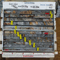
Miwah is a high-level, high sulphidation epithermal gold prospect: gold and copper mineralization is contained in andesitic and dacitic lavas and tuffs, with gold hosted mainly in andesite.
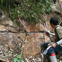
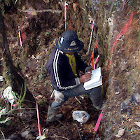
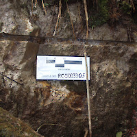
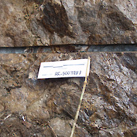
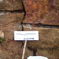
Based on historic work and the Company’s work, mineralization at Miwah is contained in two zones; a large, thick, flat lying tabular lodes that are visible at surface and define the southern extent of the upper ore body; and vertical high-grade breccia feeder zones that are contained within Miwah Main Zone. The tabular zone averages 1.28 g Au/t (lodes 2 and 3), higher grading sections exceed 4 g Au/t and the gold contents are significantly higher in breccia zones, often in the ounce per ton category. At the southern tip, over 2,000 m of rock sawn channel samples averaging 1.2 g Au/t gold have been collected. [LINK: drill results: rock sawn channel samples table]. In addition to the tabular zone the Company also characterized some of the discrete breccia feeder zones, with rock sawn channel samples including 83.59 g/t gold over 24 metres and 20.14 g/t gold over 12 metres. These feeder zones have great potential to develop into substantial tonnages of higher grade gold mineralization in an area adjacent to the Main Miwah Gold Zone.
The Miwah Main Zone remains open in all directions with great potential to the north in the adjacent area known as Moon River, an estimated 700m extension to the current strike length, and continuing further northwards towards Sipopok. Sampling and mapping west of the Miwah Main Zone in the Signal area has identified alteration that could potentially expand the east-west width another 600m and remains open. The reported NI 43-101 inferred resource block measures 1300m east-west, up to 600 m north-south, and 300m thick from the summit of the Miwah hill.
During the year ended August 31, 2016, and as at the date of this report, the Company was unable to perform the required activities on the Miwah Project due to Indonesian governmental forestry related restrictions. Accordingly, the Company is uncertain of the legal status of these IUPs under the laws and regulations of Indonesia and is not able to provide any confirmation of the status of the Miwah IUPs and the Company’s ownership interest.
In furtherance of its efforts on the Miwah project, the Company has been holding various meetings with federal and regional government officials discussing the process required to bring the Miwah Project current and in compliance with both local and federal authorities. A review and evaluation on the Miwah Project may be conducted by the regional government officials in order to resolve the status of the IUPs Exploration.
Miwah is Located in Indonesia’s Prolific Gold Production Province of Sumatra and West Java
The Miwah Gold Project is located in one of Indonesia’s most prolific gold producing area’s – Sumatra and West Java. This map shows the numerous mines in this emerging world class gold province.
-
Baru Gold Corp. has produced and filed a detailed NI 43-101 report that outline the resource potential for Miwah:
May 5, 2011
